I recently finished hiking through the White Mountains, some of the slowest toughest miles, but one if the most rewarding sections of the trail. The mountains climbed up over 4000 feet for most of the summits, and many of the miles were above treeline. The trails hit some steep slick grades, descend alongside waterfalls at some points, and traversed some of ridge lines know for some of the most unpredictable weather patterns.
Entering into the Whites I was lucky enough to slack pack a couple of days with Miss Janet and ease into it. The first mountain we encountered was Mt Moosilauke (4802ft.) Instead of taking it north and having to descend a waterfall we went south and were able to climb up it. Apparently there is a hiker challenge to hike over Moosilauke in a dress, I figured why not so McG, Cheese and I got some from a thrift shop and hiked over in them. It was quite windy and if it hadn’t been sunny it would be quite chilly, this was my first encounter with alpine/above treeline environment. It was a nice clear day so the view went on for miles, we got our first good glimpse of Mt Washington and we’re able to pick out the route we would end up taking to get there.

Moosilauke dress challenge

Moosilauke summit
We stayed in Glencliff that night at the Hikers Welcome Hostel. Next we climbed over Kinsman Mountain (4358ft,) and passed my first hut at Lonesome Lake. We stayed in Lincoln NH, at a trail angel’s (Chet’s) house. It was a nice place and I was able to hang out with Quest, the blind hiker, before he got off the trail. It was sad to see him leave, I always had good conversations with him. e always had a positive attitude. Before he left we went into Warren NH to try eating the Moosilauke Monster. Quest and McGuyver tried to take on the challenge, eat it all between two people in an Hour and a half, the pizza weighed in at about 8 pounds.

The Food Challenge

One pound slice of pizza
The next day, September 6, we were supposed to climb up Franconia Ridge and walk two miles above treeline. The weather was forecasted for rain thunderstorms all day so I decided not to set out into that. Pretty much everyone else decided that town was the safest option. It was a nice day in town hanging out with everyone, sadly my friends Acorn and Cheese had to leave the trail for a week or so. I set out to hitch out of town with with 3 other hikers. We ended up getting a ride from another Acorn who had hiked this year and summited Katahdin a few weeks earlier. She was in town to hike with a friend of hers she hiked with in the beginning of the trail, also leaving town. So we packed 5 hikers, packs and poles into a small sedan, its amazing what you can accomplish to get a ride.

Franconia Ridge
The ascent up to the ridge was rough and straight up. Acorn and her friend A-Jack caught up to me and I made it to the top with them. We summited Little Haystack (4800ft,) and climbed down and up to Mt Lincoln (5089ft,) then Mt Lafayette (5260ft.) I then camped around Mt Garfield below treeline. The next day I stopped in at a hut (Galehead Hut) for the first time to see if they had any leftovers, unfortunately they did not.
I camped in Crawford notch September 8th so I could have a full day climbing up to the presidential range. I passed Mt Jackson (4052ft) then stopped in at Mizpah Hut to regroup before starting up past the rest of the presidential range. From Mizpah it was a 13½ mile stretch above treeline. I passed Mt Clinton (4312ft) then Mt Franklin (5004ft) to end up at Lakes of the Clouds Hut where I was able to do a work for stay. I had to scrub pots that night and sweep out the hallway the next morning, but I got a warm place to sleep out of the wind and they gave us the leftovers the guests didn’t eat. It was a perfect staging area to climb to the summit of Mt Washington from at 6288 feet. The second highest mountain on the trail, and known to have some of the most unpredictable weather in one storm the wind set a record of 238 miles per hour.

Mt Washington approach

Lakes Of the Clouds Hut


View from Mt Washington

A rare view


The crew at the top (MaGuyver, Catchup, Walrus, Beans(me))

Madison Hut and Mountain
I continued on that day past Mt Adams (5500ft) and over Mt Madison (5366ft) to make it as far below treeline as possible, seeing as a storm was said to blow in that night. The storm held off long enough to get packed up and hiking the next day. I made it to Pinkham Notch where I took shelter in the cafeteria and grouped up with a bunch of hikers who were going b into Gorham to resupply and shelter from the storm that was wrecking the mountains. The next day I climbed up Wildcat and took refuge in a ski cabin after the near vertical climb after town wore me out. It also seemed like a good spot to try to catch the northern lights that were supposed to be visible that night. The next day I got a meal at Carter Notch Hut for a bit of work scrubbing bunks, I ended the day at Imp Shelter after a hard 10 miles. It was a cold windy morning and I was not to shocked to find ice on some of the trees climbing down the mountain.
At the bottom of the climb I found myself back in Gorham at the White Mountains Lodge and Hostel. McGuyver and I did a work for stay there by doing a bit of chainsaw carving.

The rough out

The final product

Plus a hiker bench

And some mushroom stools
It was probably the nicest hostel I’ve stayed at, clean and the owner Marney was the sweetest woman. It was hard to leave after zeroing for carving, but we were just miles away from Maine and it was time to enter the last state on the trail.

The MAINE line
My last night in New Hampshire, September 16th, I camped at a lake with a few other hikers, we were woken up in the morning by splashing in the water. McGuyver and I got out in time to watch two Moose in the pond. The hiking got extremely technical and involved a lot of scrambling up and down wet rocks. I slipped coming off one and slid down a bog board stretching my ankle back and causing it to stiffen up for the next few days. This happened just before the Maine border and a climb down a cliff to the shelter for the night. Again I was shocked at how rugged this trail is at times. The next day I knew I would be slow so I forced myself out of camp early. This was good because it took 4 hours to go the first 4 miles. By noon I was on the edge of the Mahoosuc Notch, claimed by many to be the hardest mile of the AT. My buddy Ted (T-Mellow) was driving up to hike a few days with me and I decided to push another 10 miles, making a long late 15 miles. Knowing that I didn’t have spare time I started my decent into the notch. When people say its the hardest mile on the trail, that its a mile of boulder scrambling, its hard to believe them. I started climbing through the notch at 1pm and I had barely gotten to the other end by 3pm only one mile further. The trail led you right through a boulder field with many of the rocks the size of a house, it wound over around and even under as many rocks as possible, three times it took you through tunnels you had to crawl under rocks.

Mahoosuc Notch

The trail crawled through here
I eventually made it to the road that night and ran into McG who told me T-Mellow was shuttling an injured hiker to town. While I was waiting in the parking lot watching stars I saw six shooting stars.
I’ve been hiking with T-Mellow for the past 5 days and over 60 miles, from Andover to Stratton. They have been some of the most challenging hiking I have done on this trail but some of the most rewarding. Southern Maine is as beautiful as it is rugged. I am also lucky to be hitting it at the perfect time of year to catch the leaves changing for fall.

Cameras cant capture the colors

Chalk art

Bald pate Mt

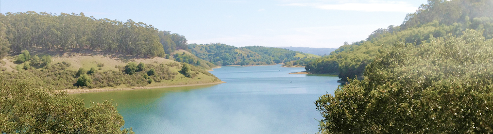
One of Maine's many ponds

Tell me that gnome totem is for sale and that you worked in it! I must have it!!! ❤️❤️❤️
Hey Beans! Great to see you’re still on the trail! I LOVED Maine ;0) Hope you’ve got Momma-K in your sights right now!